


About this app
Are you looking to enhance your Revit experience with accurate geo-referenced features? Look no further than Vicinity GIS - Oklahoma, US. This Revit plugin offers a collection of CAD Models that represent Federal, State, and local streets, highways, and roads. With each CAD Model geo-referenced to its respective NAD83 State Plane coordinate system, this plugin provides a seamless integration of real-world data into your design projects.
Features and Functionality
The standout feature of Vicinity GIS - Oklahoma, US is its comprehensive collection of CAD Models that cover various geographical features. These models are available in "dwg" format, making them compatible with all Autodesk® product categories. Whether you are an engineer, architect, or working in the geographic industry, this plugin is a valuable addition to your toolkit.
One of the key advantages of using Vicinity GIS is the ability to insert or x-reference these CAD Models into your project design models. This allows you to focus on specific areas that are relevant to your project, ensuring precision and efficiency in your design process. The models include polylines, text, and hatch entities, each separated by Layer, Color, Line Weight, and Style for easy navigation and customization.
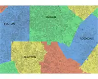
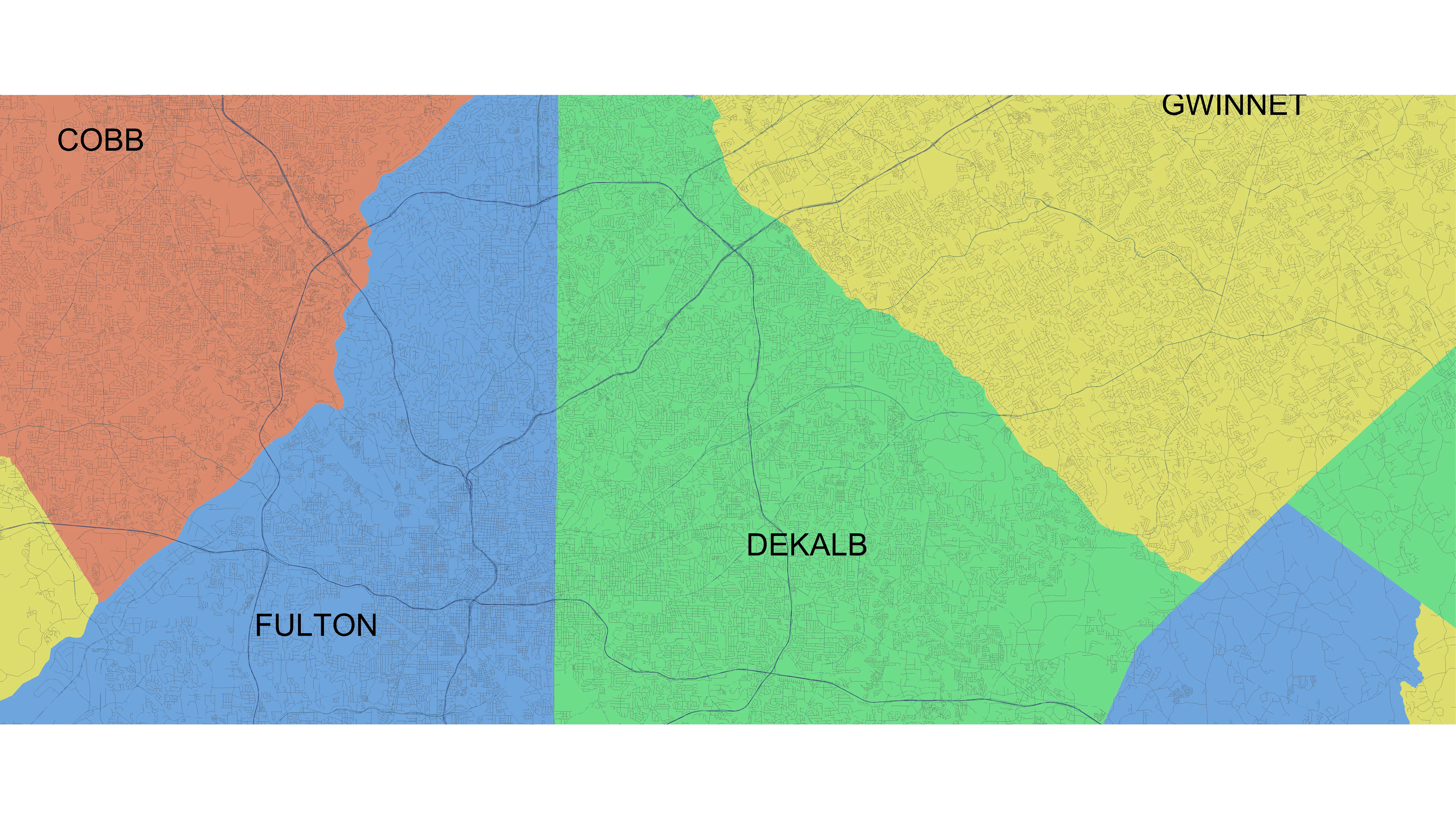
Additionally, each CAD Model includes Governmental Administrative divisions such as State, Province, County/Parish, and City, making it easy to distinguish and search for specific areas. The hatched areas provide a visual representation of these divisions, further enhancing the usability of the plugin.
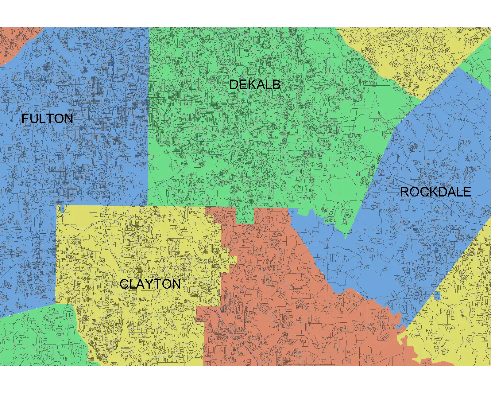
(Image by: Methodical, Cad Consulting)
Integration and Usability
One of the standout features of Vicinity GIS - Oklahoma, US is its seamless integration with Autodesk® AutoCAD® commands. Users can easily isolate, select, and search for specific features using standard commands like "Qselect" and "Find" for text entities. This user-friendly interface ensures a smooth user experience, even for those who are new to Revit plugins.
Furthermore, the geo-referenced nature of the CAD Models in Vicinity GIS ensures that they are accurate and aligned with the real-world coordinates. This level of accuracy is crucial for design projects that require precise geographical data, allowing users to make informed decisions based on reliable information.

(Image by: Methodical, Cad Consulting)
Compatibility and Accessibility
Vicinity GIS - Oklahoma, US offers compatibility with both U.S. Survey feet and the Metric System, catering to users in various countries and regions. The flexibility in units ensures that the plugin is accessible to a wide range of users, regardless of their geographic location or system of measurement.
It is worth noting that this app utilizes a dwg file for installation, which may differ from the standard App Store installer. However, this format is widely recognized in the Engineering, Architectural, Structural, and Geographic Industries, making it a reliable choice for users in these fields.
(Image by: Methodical, Cad Consulting)
Conclusion
In conclusion, Vicinity GIS - Oklahoma, US is a versatile and user-friendly Revit plugin that offers a wealth of geo-referenced features for design projects. With its comprehensive collection of CAD Models, seamless integration with Autodesk® AutoCAD® commands, and compatibility with different units of measurement, this plugin is a valuable asset for professionals in the engineering, architectural, and geographic industries.
If you are looking to enhance your design projects with accurate and reliable geographical data, Vicinity GIS is a plugin worth trying. Its user-friendly interface, precise geo-referencing, and compatibility with Autodesk® products make it a valuable addition to any Revit user's toolkit.

(Image by: Methodical, Cad Consulting)